How to Turn a Browser into an Intelligence Command Center Using Open Data
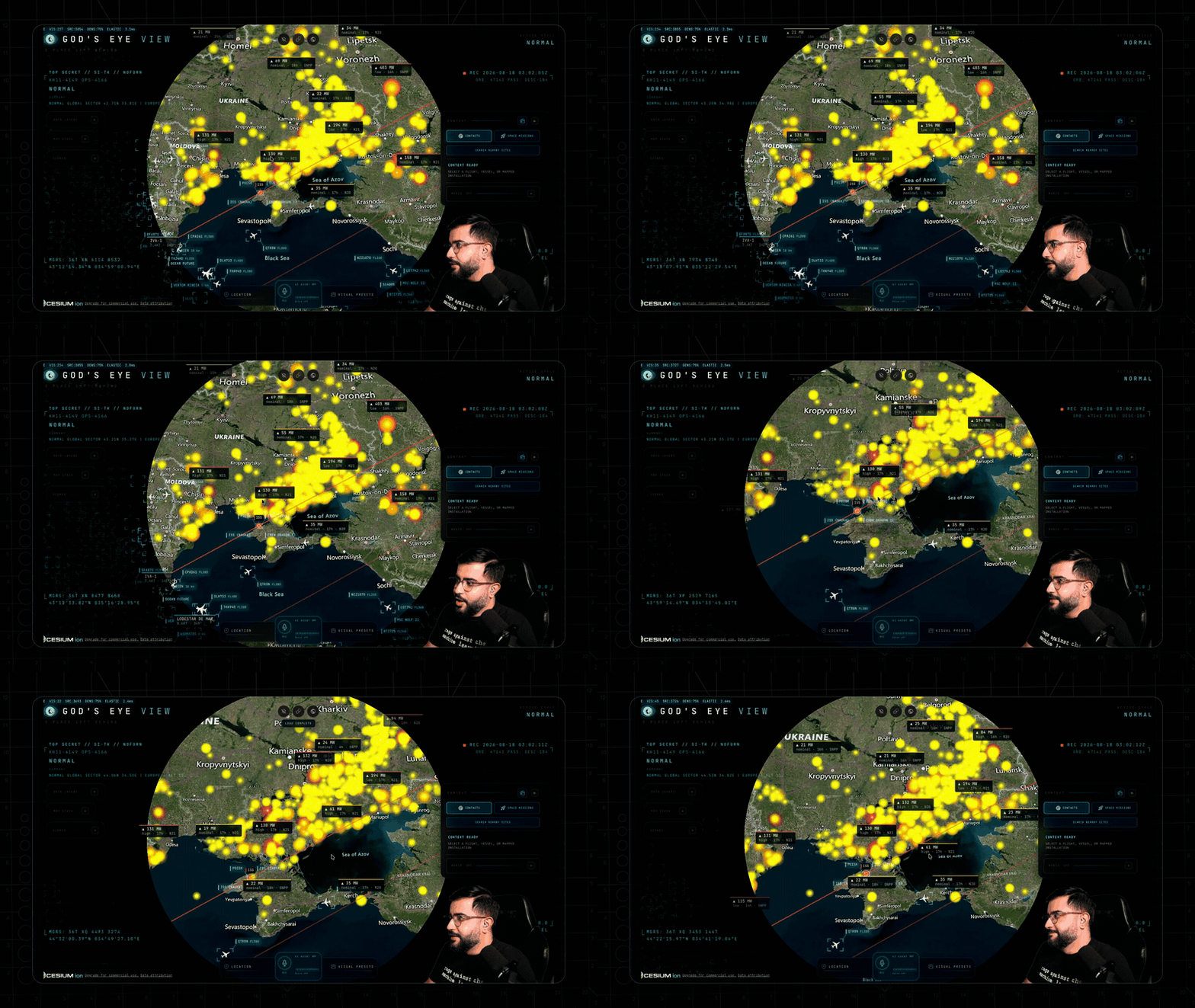
Spy movies often show massive screens with a 3D globe, where an operator tracks aircraft in real time, switches to street surveillance cameras, and points satellites. It usually looks like expensive Hollywood graphics. But in reality, almost all of these signals are open and being transmitted right now in unencrypted form.
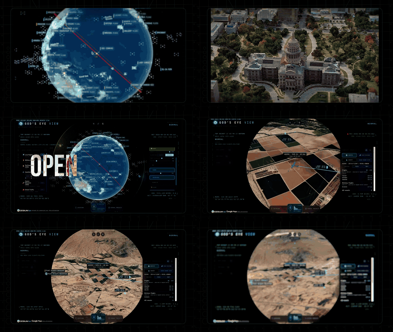
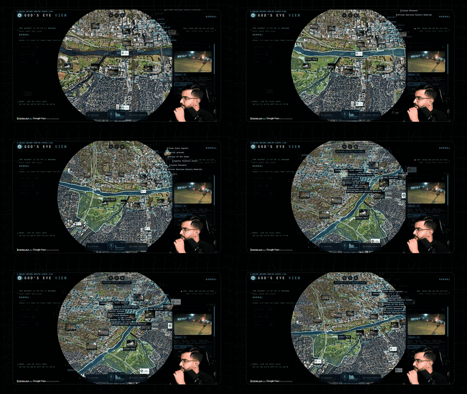
The God's Eye View project, created by developer Bilawal Sidhu, combines disparate open data sources in a single browser window based on a photorealistic 3D globe. The author ran a popular YouTube video series, gathered millions of views, and released all source code under the MIT license.
What the project can do
Usually, to gather spatial information (OSINT/GEOINT), you have to open dozens of tabs: Flightradar24 for aircraft, MarineTraffic for ships, CelesTrak satellite catalogs, and road camera sites. Here, all these layers are consolidated in one place.
Here are some interesting things you can explore live:
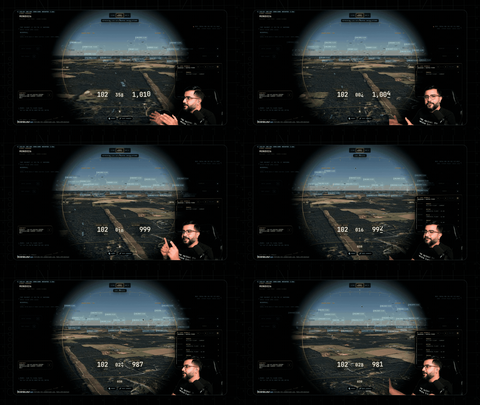
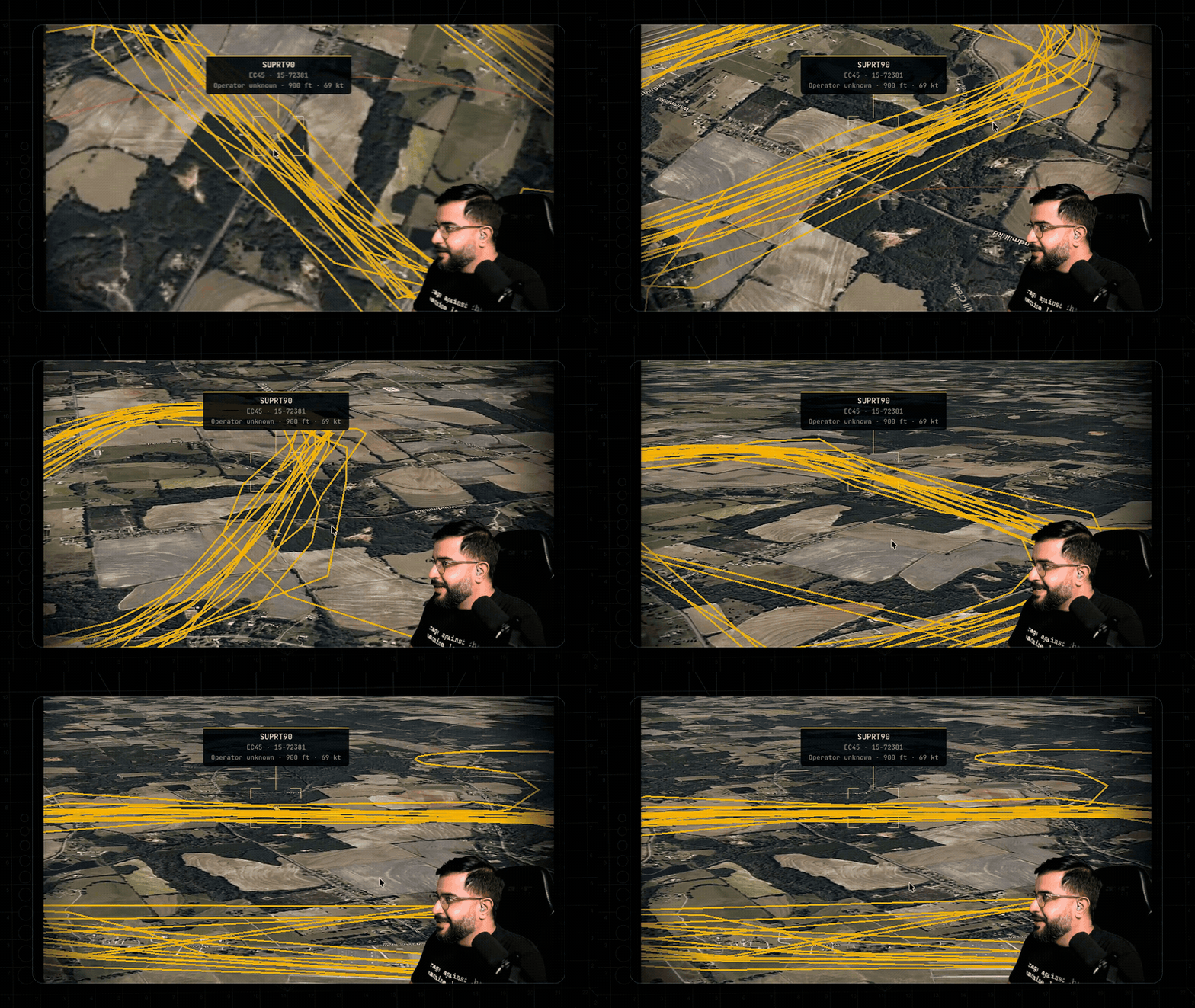
- Cockpit view. Select any real aircraft in the air, press a button, and fly along with it. The camera keeps the terrain below in frame, while a weather summary and nearby contacts are pulled up alongside.
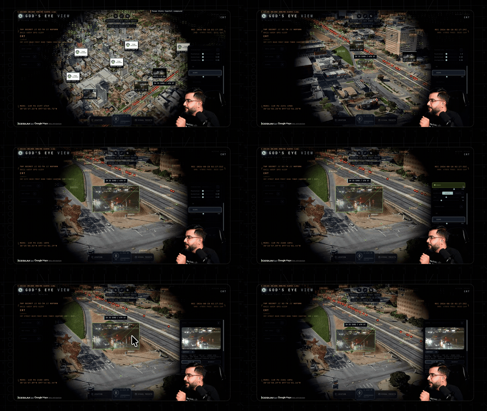
- Road camera projection directly into the 3D scene. Around 800 public cameras in Austin, London, and California are not just opened in a separate player, but projected onto intersection geometry with visibility cones.
- Satellite orbits and space missions. The globe calculates the positions of hundreds of satellites, including the International Space Station, draws trajectories, and replays recent rocket launches.
-
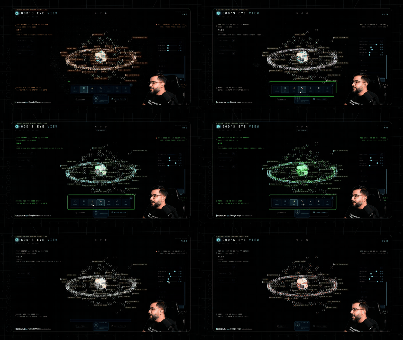
Sensor shader filters. Hotkeys can switch the image to night vision (NVG), thermal imaging (FLIR), or CRT monitor mode.
-
Voice control via neural network. If you connect an OpenAI key, the application can be controlled by voice. The agent understands coordinates, the current camera perspective, can measure distances between objects, and draw district boundaries right on top of the map.
Under the hood
There are no heavy frontend frameworks like React or Vue here. The stack is surprisingly straightforward: vanilla JavaScript, the Vite build tool, and the CesiumJS geospatial engine. The 3D planet itself is rendered using Google Photorealistic 3D Tiles.
The architecture is interesting in how the author solved typical raw geodata visualization problems:
- Smoothness with infrequent updates. Most free APIs deliver aircraft positions every 15–30 seconds. The client intentionally renders movement with a one polling interval delay and interpolates points, filling gaps with dead reckoning.
- Height anchoring. Objects don't float in the air or sink underground. Transponder heights are recalculated relative to the geoid and matched against the current polygonal terrain mesh.
- Orbit calculation. Satellite coordinates are calculated locally using the SGP4 algorithm with Greenwich sidereal time synchronization, so orbit rings don't jitter when changing perspective.
- Key security and rate limits. All requests to paid APIs (OpenAI, AISStream, TomTom) are proxied through the backend, where caching and strict rate limits on request consumption are configured.
src/
├── main.js                 # Инициализация CesiumJS и слоев
├── ui.js                   # Панели управления, HUD, стили
├── hud.js                  # Интерфейс телеметрии
├── mapStackController.js   # Переключение подложек (Google 3D / Bing / OSM)
├── iconOrientation.js      # Проекция курсовых углов техники на экран
├── voice/                  # Интеграция с OpenAI Realtime API
└── data/                   # Модули загрузки данных по каждому слою
Data sources and launch cost
Most layers work without registration and keys: aviation via OpenSky and adsb.lol, earthquakes via USGS, satellites via CelesTrak, radio stations via Radio Browser, data center and submarine cable databases.
To run the 3D terrain itself, you'll need a Google Maps API key with Map Tiles API enabled. Google provides 1000 free sessions per month. Each session lasts up to three hours of active viewing, which is more than enough for personal experiments. A working OpenAI token is needed for the voice assistant.
Quick start
Node.js version 24 or 26 is required.
Clone the repository and configure environment variables:
git clone https://github.com/bilawalsidhu/gods-eye-view.git
cd gods-eye-view
cp .env.example .env
Open the file .env, insert GOOGLE_MAPS_API_KEY, and run the project:
npm install
npm run dev -- --host localhost --port 4173
After that, the interface is available at http://localhost:4173. By default, the server only listens on the local address of the machine, so your API keys won't leak to the local network.
Who will find this useful
First and foremost, this is an excellent tutorial for web developers who want to understand WebGL, 3D tiles, the CesiumJS library, and geospatial stream processing. The code is written without unnecessary abstractions, each layer's logic is isolated in the src/data/ folder, and the voice agent implementation clearly demonstrates how to connect multimodal LLMs with a 3D scene.
If you're building your own monitoring system, a drone dashboard, or are interested in open source intelligence analysis, the project will serve as a solid framework for your own layers and visualizations.
Ähnliche Projekte